 |
|
||||||||||||||||||
|
|
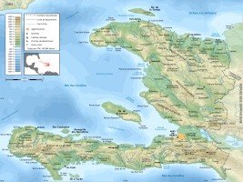
Haiti - Reconstruction : France financed the production of maps of Haiti 18/09/2013 13:34:56
The Embassy explains that "these maps are a tool for state and local institutions to better manage land development and deepening their knowledge of local issues. They are a prerequisite for any planning project. for example, the map for the town of Cité Soleil shows that the urban area has doubled in 10 years..." Printed in 2,800 copies A0, 841 mm X1189 mm, these maps will be distributed in each of the decentralized and deconcentrated state institutions. Each municipality will have a national, departmental and communal map.  "A project of data refresh is in progress order to be able subsequently make a critical analysis of the development of the territory," says the Embassy of France. HL/ HaitiLibre
|
|


|
Why HaitiLibre ? |
Contact us |
Français
Copyright © 2010 - 2024 Haitilibre.com |