Haiti - Technology : Symposium on Remote Sensing and Geomatics - HaitiLibre.com : Haiti news 7/7


iciHaiti - Football : FIFA / CONCACAF seminar on the license of D1 clubs

iciHaiti - Humanitarian : Supply of essential supplies increasingly difficult

iciHaiti - Special D1 Championship : Complete results of the first 9 days

iciHaiti - Florida : Interception of a luxury yacht filled with Haitian migrants

iciHaiti - USA : An AC-130 military plane lands in Port-au-Prince


more news


Haiti - News : Zapping...

Haiti - Education : 44 million to «offer young Haitians a better future

Haiti - FLASH : Cases of suicidal tendencies becoming more and more frequent

Haiti - FLASH : Ron DeSantis announces the successful evacuation of 722 Americans from Haiti

Haiti - FLASH : 312,000 Haitian refugees and asylum seekers around the world


more news


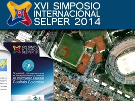
Haiti - Technology : Symposium on Remote Sensing and Geomatics
15/10/2014 12:45:04

Haiti - Technology : Symposium on Remote Sensing and Geomatics
A Haitian high-level delegation of the State University of Haiti (UEH), led by Jean Vernet Henry, Rector of the UEH and composed among others by Professor Fritz Deshommes, Vice-Rector for Research and Professor Berg P. Hyacinthe, project Coordinator of Environmental Monitoring Assisted by Satellite (SEAS-Haiti), attended the 16th symposium of the Latin American Society of Remote Sensing and Geomatics (SELPER International) to Medellin (Colombia) , which was held under the theme "Geo-information at the service of the society."

Following this participation, a chapter SELPER/Haiti has been opened, chaired by Jean Vernet Henry. This chapter will allow Haiti to obtain technological support and training in the fields of remote sensing (spatial), geomatics and other related disciplines. It will also facilitate the implementation of the remote sensing project, which is taking place at Campus Henry Christophe of Limonade https://www.haitilibre.com/en/news-7362-haiti-technology-remote-sensing-space-centre-in-haiti.html

Recall that remote sensing (spatial) and geomatics (discipline grouping practices, methods and technologies to collect, analyze and disseminate geographic data) are very important for Haiti and have applications in many fields, such as planning, prevention of natural risks and the management of natural resources, agriculture, urban planning, to name a few.

See also :
https://www.haitilibre.com/en/news-7362-haiti-technology-remote-sensing-space-centre-in-haiti.html

HL/ HaitiLibre

Twitter Facebook Rss
Send news to... Daily news...


Why HaitiLibre ? | Contact us | Français
Copyright © 2010 - 2024
Haitilibre.com